B20004-86
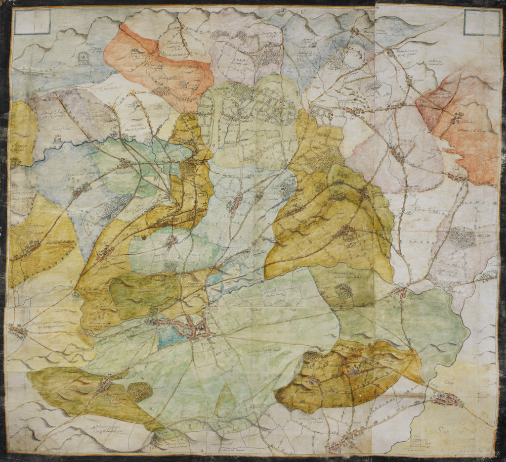
Source: Add. 52522, Whole map. Caption: Map of Sherborne, co. Dorset and neighbourhood. No compass-points, but south at top. Bounded by the manors of Poyntington, Yeovil, Woolcombe and Pulham. Each manor is coloured either in blue, green, yellow, purple, brick red, or dark pink, or is left uncoloured. Names of owners are given for nearly all the manors except those, including Sherborne itself, belonging to the Bishop of Salisbury, for whom the map appears to have been commissioned. Executed in the 'bird's-eye-view' style characteristic of maps of the period. Gives much topographical detail, including hedges and divisions. Names of manors and villages in the same ink as the map, and in an italic hand, apparently that of the cartographer. Names of landowners, etc., added in a secretary hand and in a darker ink. Endorsement: 'Sum'[set] mann[ors?]', now obscured by the linen backing. Title of Work: COLOURED MANORIAL MAP OF SHERBORNE, co. Dorset, and neighbour-hood; circa 1569-1574.. Shelfmark: Add. 52522 Author: Anon Artist/creator: Anon Place and date of production: c 1569-1574 Credit: From the British Library archiveLooking for a printed copy of this image? Please email here to request a quote for printing this image